Photography
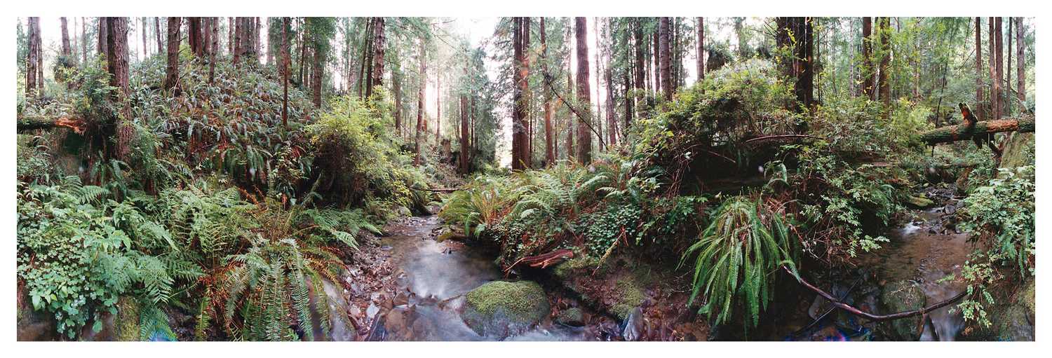
 This flattened 360 image is not from today's panorama on VRlog.com but an example of what you might see there.
We have captured over five thousand 360 degree panoramas from all over. At our microsite https://www.vrlog.com you can see a different immersive Art of Geography panorama every day. These virtual reality scenes have enough resolution to be viewed full-screen on a 4K monitor. They work well in most modern browsers and do not require any plugins. Some of the scenes are panoramas from virtualparks.org which have been rebuilt in higher resolution and open standards. Some are newer 360 degree scenes that have never been published before anywhere.
 Above Eagle Lake, Lake Tahoe area
VirtualParks.org is the result of over 24 years of hiking, exploring, and shooting panoramic photography. Since 1995, millions of people have visited VirtualParks.org and gotten a glimpse of what it's like to visit incredible wilderness locales such as Mt. Rainier, Kings Canyon, Crater Lake, Yosemite, Banff, Zion, The Three Sisters, the John Muir Trail, and hundreds of other parks and natural areas using QuickTime VR (virtual reality).
VirtualParks.org was conceived as a visual documentary of special places in North America. Natural or wilderness lands provide refuge and inspiration for people as well as habitat for other species.
The pressure of population, economic growth, park budget cuts, climate change, and catastrophic events often encroaches upon our green spaces and wilderness lands. It is my hope that through experiencing the special beauty of our wild lands, the public will better understand the value of open space and wilderness and want to preserve it for future generations to enjoy.
 Glen Pass, Pacific Crest Trail
When shooting these scenes, there was also a sense that many of these locations will never be the same again; some may improve, some may be destroyed--because geological and environmental change is inevitable. People usually think of big changes only occurring in millennial timescales, but all it takes is one natural disaster (Indian Ocean tsunami, Mt. St. Helens, earthquake on the San Andreas fault) to devastate an area for generations. Not to mention man-made disasters such as giant forest fires. These panoramas provide a unique documentary record of what specific places looked like at recorded moments in history.
 Green Creek aspens, eastern Sierra Nevada
One of the most remarkable facets of this collection of panoramas is how many were shot on film. In today's world of rapid image capture, it may be hard to imagine the amount of effort it took to create digital stitched panoramas from twelve or more individual film exposures. In many cases a single film 360 panorama took dozens of hours to get the film processed, scan all the shots, stitch them together, edit the stitched scene, and reate a virtual reality player file.
 Dege Peak, Mt. Rainer National Park
Unfortunately QuickTime VR has not been updated for today's browsers and as a result VirtualParks.org is not very easy to view unless you have an older computer that has QuickTime VR installed. The second challenge is the resolution of the scenes built in the 1990's is not high enough to look acceptable on today's monitors. Rebuilding these scenes for higher resolution and open standards is a slow process as it is not our primary or even secondary work, but rather a labor of love. You can see some of the results on VRlog.com


